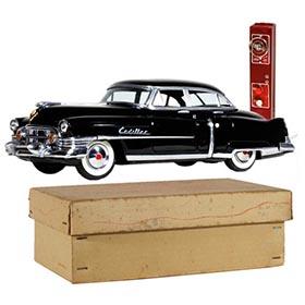
1887 McLoughlin Bros., New Dissected Map of the United States
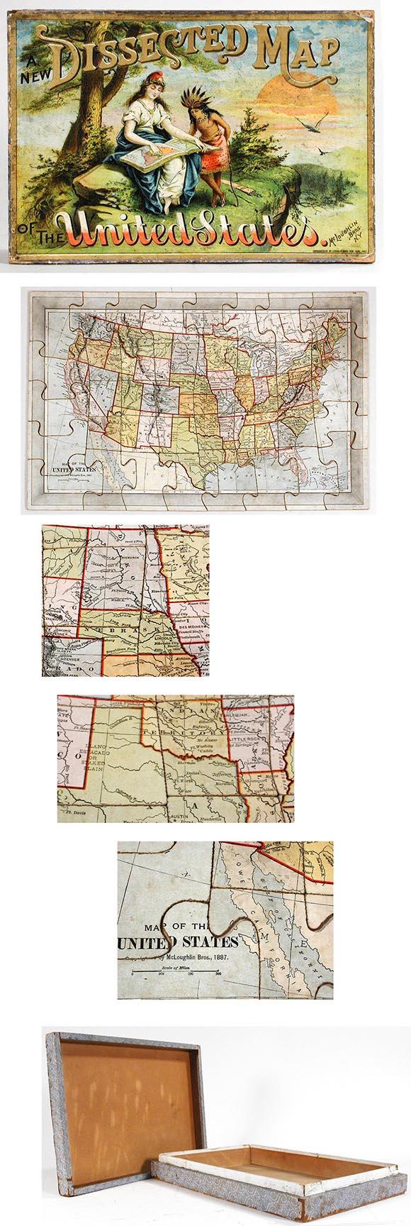
Complete set of 40 lithographed paper on wood pieces make up this classic "dissected map" puzzle of the United States. Manufactured by McLoughlin, Bros. in 1887. Comes in its original wooden box with chromolithographed cover illustration showing Lady Liberty instructing a Native American women. As with any 119 year old United States map there are location differences which have long since disappeared. Three of these are shown below. 1) Prior to separation and statehood of North and South Dakota the area was known as the Dakota Territory, 2) most of Oklahoma was simply called "Indian Territory", and 3) the Mexican Yucatan peninsula was known as "Lower California". The copyright date is printed on the map and box. The box is all wooden with a lip around the bottom to snugly accommodate the cover. Blue lithographed paper was applied to the sides. A pencil notation appears on the box bottom, "1954, purchased 67 years ago" along with the original owner's name. Size: Box 12" x 8¼" x 2". Sold: Nov. 2006
Price Sold: $ 815